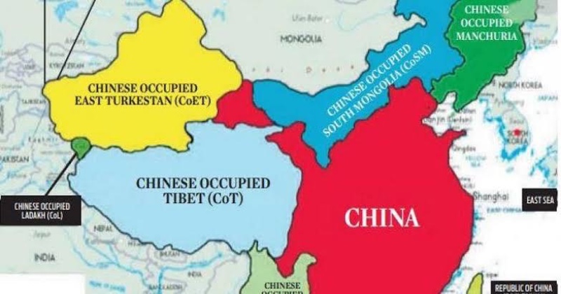
China recently released a new land-border map, asserting territorial claims over Ladakh in the north and Arunachal Pradesh in the east, challenging India’s sovereignty and integrity. However, there are two significant inaccuracies in this narrative. Firstly, historically, there has never been a direct land border between India and China. The regions of Tibet and East Turkestan have acted as buffer states separating the two countries, with imposing geographical barriers like the Karakoram and Himalayan mountain ranges further dividing India from Tibet and East Turkestan.
Secondly, Tibet and East Turkestan should not be considered as integral parts of China. Both were once independent nations that China forcibly occupied in the preceding century. Gilgit-Baltistan, a region in the Indian province of Jammu & Kashmir, is now under Pakistani control and is situated north of the Kashmir Valley. To its east lies the area referred to as ‘Xinjiang’ by China but commonly known as East Turkestan. The Chinese military invaded this region around 1949. Tibet, located to the south of East Turkestan, historically emerged as a powerful state that defeated China for extended periods but later intermittently became a vassal state. In 1951, Chinese forces captured Tibet, resulting in the Dalai Lama, Tibet’s spiritual and political leader, fleeing to India in March 1959, where he and his followers established a Tibetan Government in exile.
This historical context highlights the disputed nature of these regions and the complex dynamics surrounding China’s territorial claims and its historical aggressions in Tibet and East Turkestan.

Post Your Comments