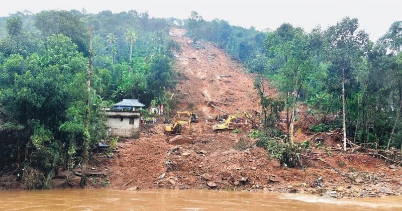
An artificial intelligence (AI)-based study conducted by the Kerala University of Fisheries and Ocean Sciences (Kufos) reveals that approximately 13% of Kerala’s land is highly susceptible to landslides. The study, in collaboration with Michigan Technological University and Indian Institute of Tropical Meteorology, Pune, used deep learning technology to create a landslide susceptibility map. Vulnerable regions include Idukki, Palakkad, Malappuram, Pathanamthitta, and Wayanad. The research, covering observations from 1990 to 2020, identifies environmental stressors and unveils heightened risk factors.
The study, titled ‘Redefining landslide susceptibility under extreme rainfall events using deep learning,’ highlights first-order stream disturbances, slope toe cutting for road construction, and unscientific land-use practices as significant contributors to the heightened risk. Additionally, slopes within the range of 10° to 40° are identified as highly prone to landslides. The findings underscore the urgency of safeguarding both populated areas and ecologically-sensitive, high-altitude regions. The research team is developing a mobile app for landslide mitigation, expected to be ready within six months.
Kufos Vice-Chancellor T Pradeepkumar emphasizes the need for coordinated efforts to address the root causes of landslide susceptibility. He states that Kerala faces unprecedented challenges due to climate variability and extreme rainfall events. The research aims to serve as a crucial tool for informed decision-making and strategic planning in addressing these challenges. The study also reveals a 3.46% rise in extreme landslide susceptibility zones in Kerala after the 2018 extreme rainfall event, necessitating targeted intervention strategies in specific districts.

Post Your Comments