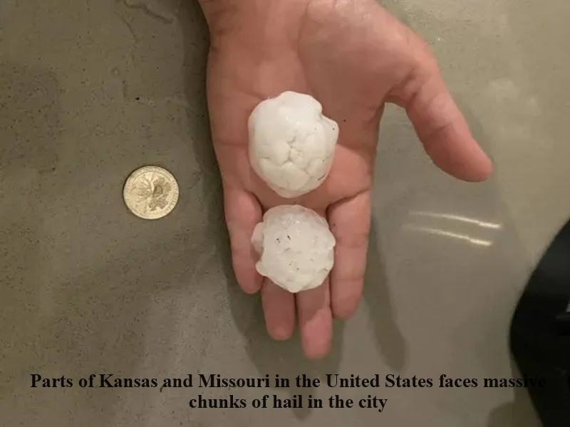
Certain regions in Kansas and Missouri, situated within the United States, encountered tumultuous weather during the evening hours of Wednesday, March 13th, as storms unleashed substantial hailstones upon the urban landscape. The National Weather Service (NWS) promptly issued a severe thunderstorm warning for the Kansas City metropolitan area, cautioning residents about an impending storm that could deliver hailstones as sizable as softballs or baseballs.
Through its platform on X, previously recognized as Twitter, the NWS urgently advised individuals within the warned areas to immediately seek shelter indoors, emphasizing the potential hazards posed by the incoming weather phenomena. Earlier reports from the weather service indicated that the storm had already generated hailstones of considerable magnitude, comparable to the size of softballs.
Updates from the NWS on X further revealed that due to the adverse weather conditions, traffic flow along a section of Interstate 70 had been brought to a standstill. Meanwhile, across regions near Topeka, tornado warnings were issued alongside severe thunderstorm alerts for areas northeast of Kansas City, Missouri.
Alex Sosnowski, a senior meteorologist at AccuWeather, characterized the anticipated hail as resembling “gorilla hail,” attributing this designation to its anticipated colossal dimensions. This term underscores the sheer magnitude of the hailstones expected to descend upon the affected areas, highlighting the potentially destructive nature of the impending weather event.

Post Your Comments