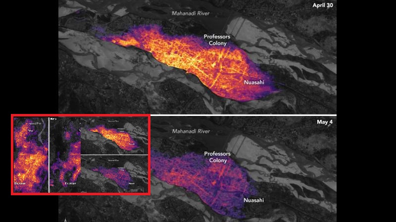
National Aeronautics and Space Administration (NASA) has now released the images of affected areas of Fani. These images bring the comparison before and after the cyclone made landfall in the region.
Fani was one of the worst cyclones that India has seen in the past two decades and left millions without electricity for almost four days.
A blog post by NASA read: “These images were made from data acquired by the Visible Infrared Imaging Radiometer Suite (VIIRS) on the Suomi NPP satellite. VIIRS has a ‘day-night band’ that detects light in a range of wavelengths from green to near-infrared, including reflected moonlight, light from fires and oil wells, lightning, and emissions from cities or other human activity.”
Power outages in #Bhubaneswar and #Cuttack after Cyclone #Fani. https://t.co/X7A9NYDsGi #NASA #India pic.twitter.com/fA4raahpyb
— NASA Earth (@NASAEarth) May 8, 2019

Post Your Comments