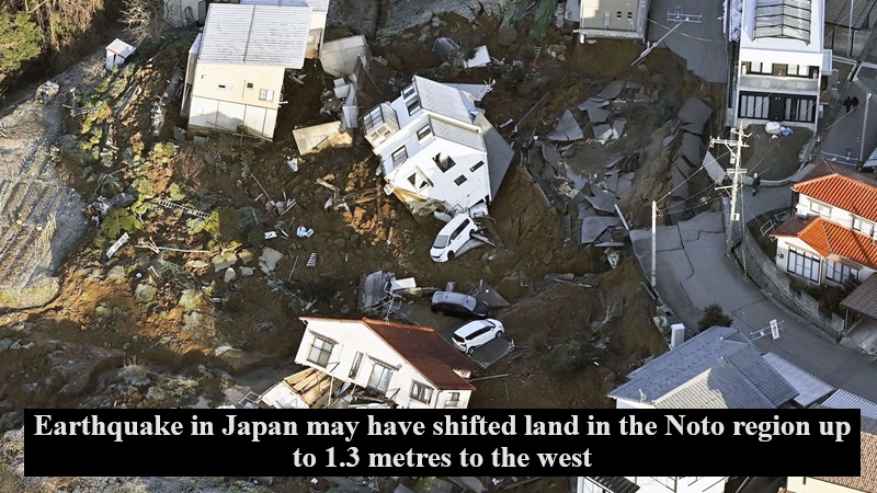
Japan experienced a seismic catastrophe on Monday, marked by a formidable earthquake with a magnitude of 7.6, claiming the lives of at least 48 people and leaving a trail of widespread devastation. The epicenter was located in the Noto region, and the aftermath suggests significant land shifts, with the potential displacement of up to 1.3 meters westward, as reported by Japan’s Geospatial Information Authority (GSI). This revelation stems from the analysis of GPS data by the national institution responsible for surveying and mapping the country’s land.
Preliminary findings indicate a substantial horizontal shift of approximately 1.3 meters to the west at an observation point in Wajima City, Ishikawa Prefecture. Additional measurements include a one-meter westward movement in Anamizu Town and an 80-centimeter shift westward in Suzu City. Nanao City’s Notojima observation point experienced a 60-centimeter northwestward shift towards the Sea of Japan coast.
The aftermath of the earthquake is grim, with aerial news footage capturing the immense scale of a fire that engulfed the old market area of Wajima, resulting in the collapse of a seven-storey commercial building. Power outages affected thousands of homes in the region, compounded by freezing temperatures overnight, while numerous cities faced water shortages.
The U.S. Geological Survey reported a magnitude of 7.5 for the earthquake, slightly differing from Japan’s meteorological agency, which measured it at 7.6. The seismic activity continued with more than 210 aftershocks in the region through Tuesday evening, including a 5.6 magnitude jolt that prompted national broadcaster NHK to switch to a special program.
The catastrophic earthquake has left Japan grappling with the immediate consequences of loss and destruction, emphasizing the urgent need for relief efforts and comprehensive recovery strategies in the affected regions.

Post Your Comments